Kula Geopark is one of those places where the Earth feels awake even when everything is technically extinct. For The Other Tour, this is exactly the kind of landscape we love: deep time, human stories, and a bit of eerie silence under your feet.
Table of Contents
The Formation of a Volcanic Landscape
Kula–Salihli UNESCO Global Geopark, located in western Turkey within Manisa province, preserves one of the most complete volcanic landscapes in Anatolia. Spanning roughly 232,000 hectares across the Gediz Graben, this region records multiple phases of Quaternary volcanism, with eruptions beginning around 1.7 million years ago and continuing until as recently as 2,600 years ago.
These eruptions formed basalt plateaus, scoria cones, and extensive lava flows that reshaped valleys and redirected sections of the Gediz River. At the center of this terrain lies the Kula volcanic field, historically known as Katakekaumene, or “the burnt land,” a name recorded by the geographer Strabo.
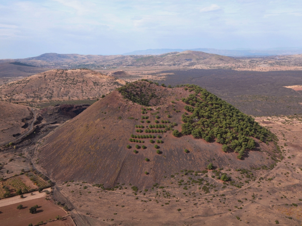
The landscape still reflects this identity: black lava surfaces, frozen flow formations, and sparse vegetation across younger rock. Divlit Tepe, rising about 170 meters above its surroundings, represents one of the most recent volcanic phases, with lava flows extending across more than 20 square kilometers.
Humans in the Shadow of Volcanoes

Kula is not only a geological archive but also a record of human presence within an active volcanic environment. Near the Çakallar cone, fossilized human footprints preserved in volcanic ash have been dated to approximately 4,700–5,000 years ago, placing them in the Bronze Age.
These tracks, attributed to a small group that included adults and children, suggest that people were moving through the area during or shortly after an eruption event. Additional evidence from nearby rock surfaces, including painted depictions interpreted as erupting craters and flowing lava, reinforces the idea that these communities directly observed volcanic activity.
The Magma Valley Walkway

To make this raw terrain accessible, the geopark built a 2.7 km walking path (one way) through the lava fields, with low walls of volcanic stone guiding you and interpretation panels at key geosites.
About halfway along, there are three wooden bridges spanning the lava channels and fractures – this is the bit many visitors remember as Magma Vadisi.
The trail’s edges are lined by low basalt stone walls and distance signposts, helping visitors navigate the park’s lava flows with minimal impact.
Geological Features and Lava Formations
The walkway traverses AA-type basalt lava flows from Kula’s youngest volcanic phase (c. 30,000–2,600 years ago). These recent lavas blanket roughly 20.7 km and form a rough, clinkery surface with collapse pits and hornitos (upturned lava bubbles).
Visible along the route are features of the Divlit volcanic field: a nearby cinder cone (Kula-Divlit) and numerous small spatter cones formed by lava fountaining. In places, older basalt flows exhibit columnar jointing. Visitors walking the path may also see collapsed lava tubes and channels cut through the flows.
Kuladokya: Kula’s Counterpart to Cappadocia
Kula Peribacaları, known as Kuladokya, is a small but distinct fairy chimney field in western Turkey. Unlike Cappadocia’s volcanic tuffs, these formations developed from ancient lake sediments deposited around 14 million years ago. Over time, erosion and tectonic uplift shaped them into spires and columns with harder cap rock, creating a landscape formed through long-term surface processes rather than volcanism.
Covering about 152 hectares near the Gediz River, the site was declared a Natural Monument in 2012. It sits within the wider Kula volcanic province, historically called Katakekaumene or “the burnt land” by Strabo. Today, the formations stand among scrubland, farmland, and the traditional Ottoman houses of Kula town, where geology and lived heritage exist in close proximity.
Homoerectus Valley: Deep-Time Human Landscape
Homoerectus Valley in Kula–Salihli Geopark is named after Homo erectus, an early human species that lived during the Pleistocene and spread across Eurasia. The designation places the valley within the broader framework of human evolution in western Anatolia, where early hominin activity is evidenced in nearby regions.
Although no Homo erectus fossils have been found in the valley itself, surrounding areas in western Turkey provide evidence of early human presence dating back over a million years. Within the geopark, the valley serves as an interpretive link between deep human history and the much younger volcanic landscape of Kula.
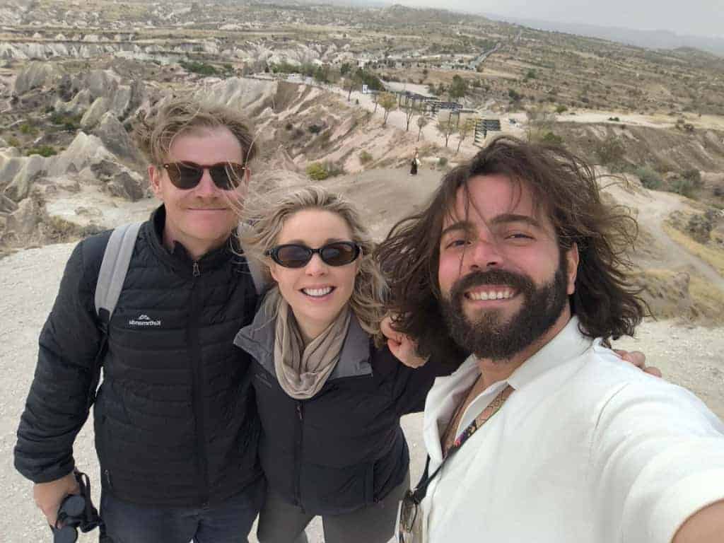
If you want to skip dry, scripted lectures for an energetic, laughter-filled exploration of Turkey’s many attractions, Anıl is your guy.
Quick Summary for Explorers
Kula Geopark lies in Turkey’s Aegean Region, in Manisa Province, near Kula and Salihli. It is a striking volcanic landscape of lava fields, basalt rocks, ancient cones, and unusual rock formations — one of Turkey’s most fascinating geological open-air museums.
| Attribute | Detail |
|---|---|
| Distance | ~2.7 km one-way (6 km round-trip) |
| Bridges | 3 wooden bridges (midpoint of trail) |
| Surface | Unpaved volcanic gravel/dirt (stone-edged path) |
| Estimated Time | ~2–3 hours (round-trip) |
| Difficulty | Easy–Moderate (mainly flat; uneven surface) |
Is Kula Worth the Detour?
Kula Geopark is worth visiting if the focus is geological depth, solitude, and landscapes that remain largely untouched by mass tourism. It combines volcanic fields, ancient sedimentary formations, and tectonic features within a relatively compact area, offering a rare cross-section of Earth’s history in western Turkey. The experience is quiet, observational, and rooted in place rather than infrastructure.
What sets it apart is not spectacle but authenticity. Lava fields at Divlit Tepe, fairy chimneys at Kuladokya, and Homoerectus Valley as a geological–historical reference point all exist within a short driving radius.
For visitors willing to move beyond conventional routes, Kula offers a layered landscape where geology, archaeology, and regional history intersect without heavy commercialization or crowding.
Get in Touch for Tour Guide
Exploring Kula Geopark is significantly more meaningful with a structured, locally informed guide. The terrain combines volcanic fields, sedimentary formations, and culturally significant sites that are easy to overlook without context.
A guided experience helps connect locations such as Divlit Tepe, Kuladokya, and Homoerectus Valley into a single historical and geological narrative rather than isolated stops. If you are planning a visit, you can reach out to arrange a curated route based on your time and interest level.
Fill out the form below with your travel details, and our team will help design an itinerary that covers key sites across Kula–Salihli Geopark, ensuring efficient access and contextual understanding throughout the journey.


